Around the year 900 AD, the provinces of the Calusa, Mayaimi and Tekesta in southern Florida merged into one political entity that was the scale of a nation. 1 Almost immediately, the same styles of pottery were being produced in all three provinces, and the Mayaimi town of Wakate (Guacata in Castilian) began to grow rapidly. This archaeological zone is also known as Belle Glade Mounds. It is located in Palm Beach County, Florida.
The location of Wakate was at the base of a peninsula that extended into the southeast corner of Lake Okeechobee. Canoes departing from Wakate could access all sections of the lake, plus traverse the extensive canal system in southern Florida. The Belle Glade Mound, which was excavated in the 1930s and gave its name to the Belle Glade Culture is on the southeastern end of the Wakate archaeological zone, west of the town of Belle Glade.
At this same time that Wakate rose to prominence, a trading village was founded 450 miles to the north on a terrace overlooking the Ocmulgee River in what is now Macon, GA. 2 That place is now called Ocmulgee National Monument. Over the following 250 years the trading village would grow to a megapolis of at least seven neighborhoods and 25 more satellite towns and villages.

Creek Indian tradition is that the trading on the Ocmulgee was called Waka-te or Waka. The “te” is the Itza Maya suffix for “people or tribe.” During the 1700s and early 1800s, Waka was the name of a Creek town on the Chattahoochee River in Georgia. 3 Many of the Chattahoochee River towns had formerly been located on the Ocmulgee River.
Wakate was located on the most important canal that connected the Atlantic Ocean with Lake Okeechobee and then, the Gulf of Mexico. 4 However, more so than any other indigenous town in the Lake Okeechobee Basin, Wakate developed an internal canal system which interconnected neighborhoods within the large town. Eventually, several major roads, built on causeways also interconnected Wakate with other towns of the new nation.
The name Wakate is highly significant. The town’s name could very well be the Hitchiti (Eastern Creek) word Wakate = Waka People. The Spanish often Latinized Muskogean words by changing the “te” locative suffix to “ta.”
The Guatemalan Maya city of Waka
Waka or El Perú was an important salt trading city at the edge of the Guatemalan Highlands. 5 Its geographical situation was identical to that of the acropolis at Ocmulgee National Monument. The Guatemalan and Georgian towns were the same distance from the ocean and located on the Fall Line of a major river. Both towns had an inner harbor created by an old horseshoe bend in the river.
Teotihuacan began appointing the kings of the Itza Maya in Chiapas around 200 AD. 6 A stone stela in Waka records the first meeting between diplomats of Teotihuacan and the Guatemala Maya. This occurred at Waka’ in 378 AD, 10 days prior to the arrival of Teotihuacan’s representatives in Tikal, located in the Peten Jungle Lowlands of Guatemala. This moment is known among Mesoamerican archaeologists as “La Entrada.” Soon thereafter Waka’ became allied with Tikal.

In the 600s, Waka’ dropped Tikal as an ally and became an ally of Calakmul, Tikal’s arch rival. This alliance was strengthened by K’inich Balam (“Sun Faced Jaguar”), who ruled from the late 7th century to the early 8th century. He was married to Lady T’abi, a royal princess from Calakmul. The political marriage intertwined Waka to Calakmul in a dangerous military alliance.
Waka’s demise can be directly attributed to its alliance with Calakmul. Tikal conquered Calakmul. Calakmul’s ruler Yik’in Chan K’awiil, likely the brother of Lady T’abi, was captured, and sacrificed in Tikal’s central plaza in 732.
Waka’ then became a vassal of Tikal. Yik’in Chan K’awiil conquered Waka’ in 743. After his victory he brought an image of a celestial serpent from Waka’ to Tikal.
According to archaeologist Robert Sharer the celestial serpent was probably Waka’s patron deity. This is important information because stone and earthen effigies of the Celestial Serpent are found on mountain tops in northern Georgia and at the Ortona archaeological zone near Lake Okeechobee.
Some people continued to live in the sacked town of Waka until around 880 AD. This was approximately two decades before the radiocarbon date of the base of the Great Temple Mound at the trading center on the Ocmulgee River in Georgia and the substantial expansion of Wakete in the Lake Okeechobee Region. The towns in Florida and Georgia could be slightly older because radiocarbon dating only provides the approximately age of organic material.
Exposure of artifacts by dropping water levels

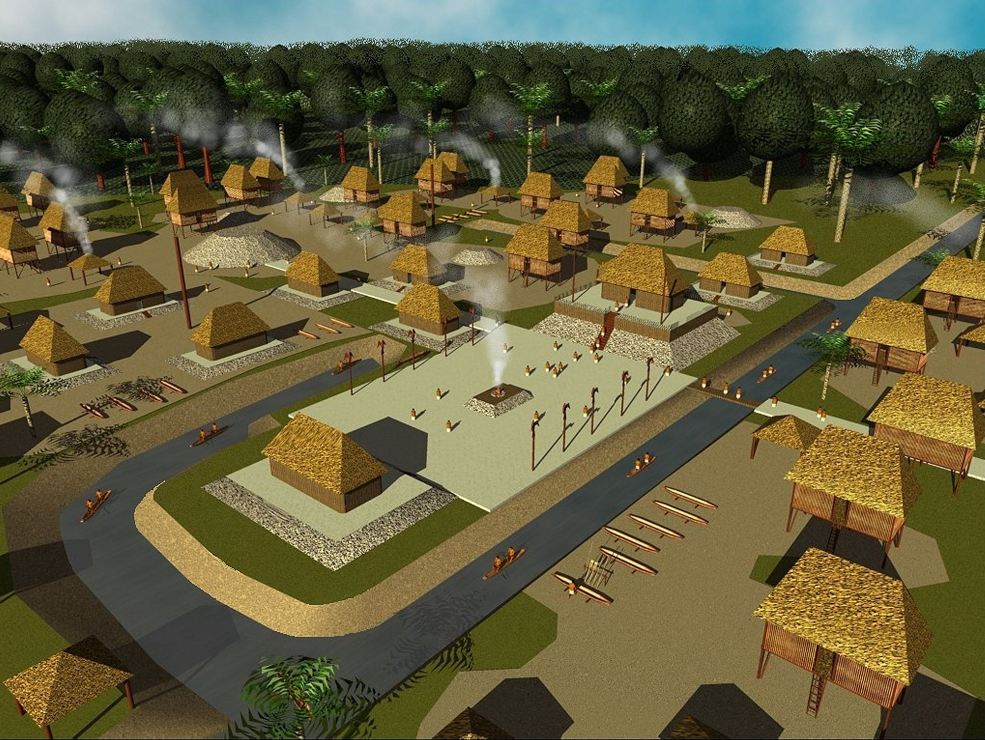
Since the late 1800s, both Lake Okeechobee and the Everglades have shrunk considerably due to the construction of drainage and irrigation canals. The Mayaimi constructed dams and locks so that their canal system did not lower the water levels. Apparently, the Wakate site was then subject to periodic flooding. This environmental condition affected the construction and appearance of its architecture. The homes and temples of the elite were raised on mounds. The commoner’s houses were set upon posts.
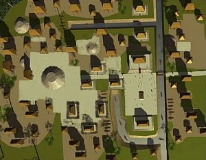
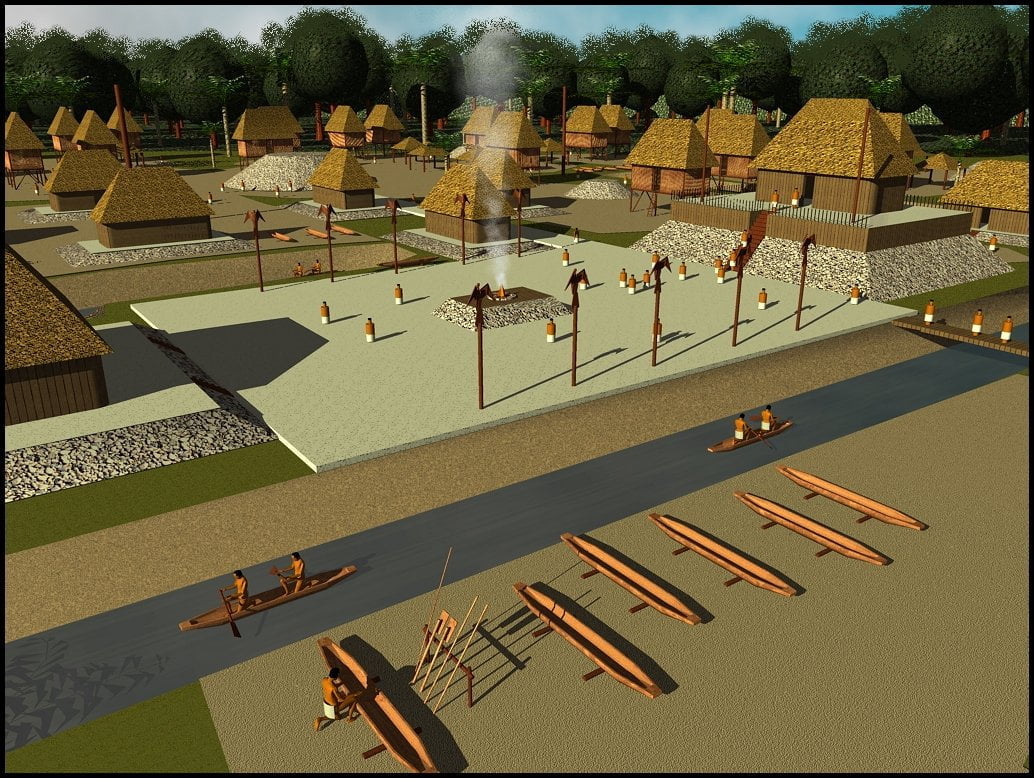
The most important buildings of Wakate were clustered around the intersection of the two major canals. 7 A branch canal led directly to the central plaza. An adjacent lagoon served as inland harbor. Smaller canals created a transportation network, which enabled residents to move bulk goods about town or to other parts of the region.
The mounds at Wakate were constructed out of crushed shells, or sandy soil, veneered with crushed shells and a crude lime made from burned shells. 8 The plazas were paved with a compacted mixture of crushed shells and sand. The houses of the elite were built on low mounds. Everybody else built their houses on timber piles that elevated the living areas above flood waters. It is interesting that the barns of the Creek Indians were very similar to houses of Wakate and other Mayaimi towns. The elevated barns helped protect stored foods from dampness and rodents.
Apparently, both the public buildings and houses at Wakate were constructed with lightweight pole frames and walls woven like baskets from split canes and reeds. Little remains of the buildings other that the black humus in the soil where posts and columns once sat.
Most of the towns around Lake Okeechobee were abandoned around 1150 AD. 9 There was no new construction at the acropolis of Ocmulgee after this date too. Wakate’s lifespan corresponds exactly to that of the great city of Tollan in the Central Mexican Highlands. 10 Tollan was capital of the Toltec Empire. Wakate’s life span also corresponds to the time that the Ocmulgee Acropolis was occupied. These chronological correlations have not been explained by archaeologists, to date.
Citations:
- Johnson, William G. (1992.) “Part II: Archaeological Contexts: Chapter 11. Lake Okeechobee Basin/Kissimmee River, 3000 B.P. to Contact.” Florida’s Cultural Heritage: A View of the Past. Tallahassee, Florida: Division of Historical Resources, Florida Department of State: pp. 81-90.[↩]
- Thornton, Richard L. (2008) Ancient Roots III: The Indigenous People & Architecture of the Ocmulgee-Altamaha River Basin. Raleigh: Lulu Publishing; pp. 124-126.[↩]
- Mitchell, John (1755). Map of North America.[↩]
- Johnson, William G. (1992.) “Part II: Archaeological Contexts: Chapter 11. Lake Okeechobee Basin/Kissimmee River, 3000 B.P. to Contact.” Florida’s Cultural Heritage: A View of the Past. Tallahassee, Florida: Division of Historical Resources, Florida Department of State: pp. 81-90.[↩]
- Breuil, Véronique, Laura Gamez, James L. Fitzsimmons, Jean-Paul Metailie, Edy Barrios, and Edwin Roman (2004) Primeras noticias de Zapote Bobal, una ciudad maya clasica del norocidente de Peten, Guatemala. Mayab 17: 61-83.[↩]
- Breuil, Véronique, Laura Gamez, James L. Fitzsimmons, Jean-Paul Metailie, Edy Barrios, and Edwin Roman (2004) Primeras noticias de Zapote Bobal, una ciudad maya clasica del norocidente de Peten, Guatemala. Mayab 17: 61-83.[↩]
- Breuil, Véronique, Laura Gamez, James L. Fitzsimmons, Jean-Paul Metailie, Edy Barrios, and Edwin Roman (2004) Primeras noticias de Zapote Bobal, una ciudad maya clasica del norocidente de Peten, Guatemala. Mayab 17: 61-83.[↩]
- Breuil, Véronique, Laura Gamez, James L. Fitzsimmons, Jean-Paul Metailie, Edy Barrios, and Edwin Roman (2004) Primeras noticias de Zapote Bobal, una ciudad maya clasica del norocidente de Peten, Guatemala. Mayab 17: 61-83.[↩]
- Breuil, Véronique, Laura Gamez, James L. Fitzsimmons, Jean-Paul Metailie, Edy Barrios, and Edwin Roman (2004) Primeras noticias de Zapote Bobal, una ciudad maya clasica del norocidente de Peten, Guatemala. Mayab 17: 61-83.[↩]
- George L. Cowgill (March 2004). “Ancient Tollan: Tula and the Toltec Heartland” 78 (299). Antiquity. pp. 226-227.[↩]
