North Americans just don’t usually think of their indigenous peoples as having sophisticated, regional societies, public works or long distance trade. Perhaps the Hollywood portrayals of Plains Indians has created too much of a stereotype. Mexicans and Central Americans, of course, take pride in their pre-European heritages. They are not surprised when they hear that the Mayas built some canals or that the Purepeche interlaced Michoacan with roads.
Archaeologists currently believe that the indigenous peoples of Florida did not have beasts of burden. Several types of dogs were kept for hunting, companionship or meat, but no evidence of them pulling loads has been found to date. There were no horses or oxen in Florida from the end of the Ice Age until the arrival of Spanish colonists in the late 1500s. As yet, no evidence has been found that manatees or dolphins pulled canoes. That left two options for transportation of bulk goods, canoes over waterways and/or human porters by land.

Unless cleared of dense vegetation and drained, the swampy terrain of southern Florida was not the same type of barrier to foot travel as the mountains, but it nevertheless, slowed down the pace. On the other hand, as much as a ton of cargo could be carried on a large freight canoe, and at a much faster speed than walking. Bulk transportation stimulated commerce, which in turn stimulated the craftsmen to produce art objects and farmers to grow more crops than they needed for their families. Both art and food stuffs could be easily transported from town to town via canoes; especially if connected by straight, wide canals.
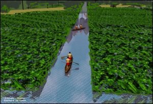
It was in southern Florida, however, that an indigenous people built the Western Hemisphere’s largest water transportation network. Between 300 AD and 1150 AD archaeologists think that the Mayami, Calusa and Tequesta peoples built hundreds of miles of canals. Some of the canals were as wide as 25 feet 1 Such a dimension suggests that there was very heavy canoe traffic on certain routes. Other canals were merely 6 feet wide swaths cut through the dense foliage of the Everglades and other smaller, wetlands. When linked together, this system enabled travelers and merchants to transverse the entire width of the Florida Peninsula; from the mouth of the Miami River to the mouth of the Caloosahatchee River. The southwest Gulf Coast of Florida contains many islands and tidal channels, which extended the range of canoes far beyond the mainland.
Water Transportation around Lake Okeechobee

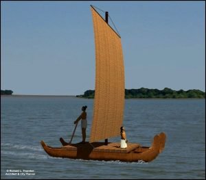
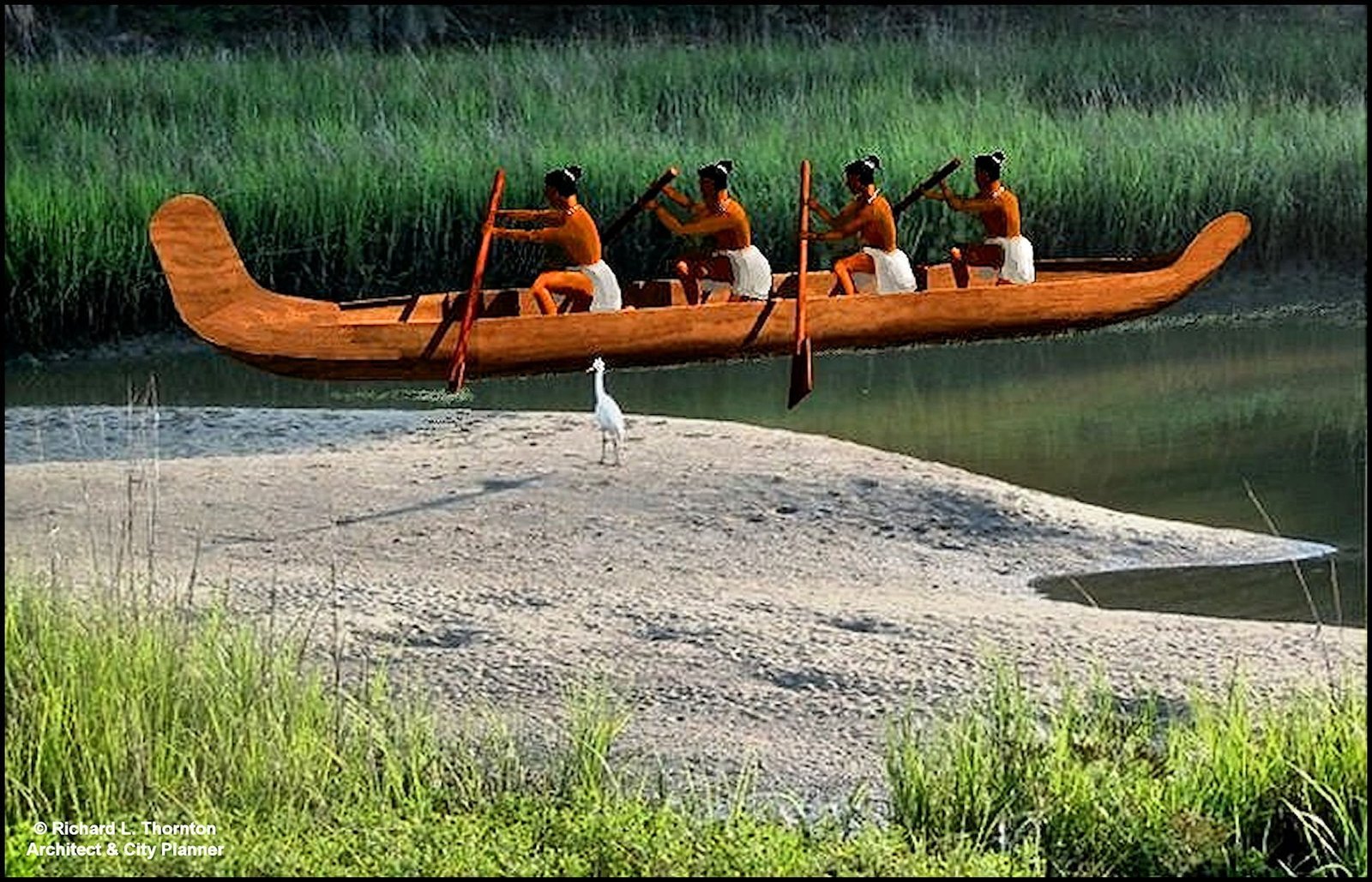
The canoes that traveled on this extensive ancient canal system varied considerably in size, but apparently were of a single style. One of the many bits of evidence that there was direct cultural contact between the Maya’s of Yucatan and the peoples of southern Florida was the shape of the Florida canoes. 2 Even when the Floridians hewed out simple dug-out canoes, they mimicked the flared bow and stern of an Itza Maya canoe or plank-built Chontal Maya sea-going vessel. Small, one and two occupant canoes could carry hunters, fishermen and travelers thought shallow streams and the Everglades. Larger four-to-six passenger canoes hauled goods on the smaller canals. Massive freight and war canoes could carry as many as sixty paddlers – or fewer paddlers plus cargo containers.
When the English took control of Florida in 1763, the flared Maya-style canoes were apparently no longer being built. Creek Indians from the Carolinas, Georgia and Florida were rapidly re-occupying the lands once held by the almost extinct indigenous peoples. They built simple dug-outs that in plan resembled stub end cigars.
However, the Creeks still made ceramic pipes that recalled ancient memories of large, “feather serpent” trade canoes prying up the rivers of South Carolina, Georgia and Alabama. The campfire stories remembered first the terrifying raids by strangers seeking slaves, but in the centuries that followed the contacts shifted to commerce and cultural exchanges. Note that the pipes in the composite image above have rudders and flared bows & sterns. In addition to the evidence of Creek “feathered serpent canoe pipes,” archaeologists in recent years have actually discovered these distinctive canoes where they were preserved in the peat around Lake Okeechobee.

The change from crude canoes beaching on the sandy banks of streams near villages to a complex network of canals that interconnected communities, resources and markets, was probably an evolutionary one. The technological advancements seem to accelerate around 600 AD. 3 By 900 AD the three principal chiefdoms of southern Florida were so well connected by transportation routes, that it was possible to create something approximating a state or small nation.
By the tenth century, many Okeechobee towns had become essentially, inner harbors. Large freight canoes could travel from the coast with marine prestige goods or shells for construction, then return back to the coast with produce and preserved meats. Some towns even had branch canals that could take travelers literally up to the steps of temples or houses of the elite. Apparently, the Mayami canoes made long voyages up the coasts of Florida and made contact with people living inland as far as the “Fall Lines” that blocked passage of all boats. The regional commerce stimulated villages to grow into towns, and major towns to build architectural monuments that would later become the models for architecture throughout the lower Southeast and Mississippi River Basin.
In the articles on Ocmulgee National Monument, evidence will be presented that strongly suggest trade via the Atlantic Coast and Altamaha River between Ocmulgee and southern Florida, or perhaps even Cuba and the Yucatan Peninsula. At the time of early Spanish explorations, the Calusa were still regularly making trading voyages to Cuba. They were also at least aware of the location of the Itza Maya (Post-Classic) cities in the Yucatan Peninsula.
Land Transportation around Lake Okeechobee
The indigenous people of southern Florida also built straight roads that connected major towns. 4 These were not mere trade paths like the rest of North America, but public works projects on the scale of the roads of the Roman Empire. Archaeologists from the University of South Florida have discovered massive earthen causeways that were constructed across swamplands to enable the roads to continue in straight paths. Why were wide, straight roads needed in a Neolithic society (without wheeled vehicles) which also developing an extensive canal system? Did large numbers of people walk between towns? Was there a slave class in southern Florida like in the Yucatan, who endured short brutal lives as human beasts of burden? There are many questions that can’t be answered without more comprehensive archaeological studies.
An aspect of southern Florida’s fluorescence that currently puzzles anthropologists is that to date, no evidence of large scale agriculture has been identified, yet the scale of town development, architecture and transportation improvements would seem to require a population, far larger and denser, than one would expect for “hunter & gatherer” societies. Digging canals and building roads requires large pools of laborers, who can be spared from hunting and fishing. Towns with large religious shrines would need surplus food year round to feed priests, retainers and construction workers. Could the natural resources of the Lake Okeechobee Basin support hierarchal societies without cultivation of the land and domestication of animals? Perhaps the people grew vegetable intensely in raised beds. Perhaps they grew highly productive crops that have not been identified. These are also unanswered questions.
Citations:
- Ancient Native American Canal System. Ortona, Florida GPR Survey April, 2004.[
]
- Carr, Robert S., Dicke, David & Mason, Marilyn. “Archaeological investigations at the Ortona Earthworks and Mound.” The Florida Anthropologist, Vol. 48, No. 4. December 1995.[
]
- Carr, Robert S., Dicke, David & Mason, Marilyn. “Archaeological investigations at the Ortona Earthworks and Mound.” The Florida Anthropologist, Vol. 48, No. 4. December 1995.[
]
- Carr, Robert S., Dicke, David & Mason, Marilyn. “Archaeological investigations at the Ortona Earthworks and Mound.” The Florida Anthropologist, Vol. 48, No. 4. December 1995.[
]
