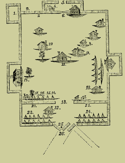
A copy of a map of Fort Mims. This map was found among the papers of General Claiborne.
- Block house.
- Pickets cut away by the Indians.
- Guard’s Station.
- Guard House.
- Western Gate.
- This Gate was shut, but a hole was cut by the Indians.
- Captain Bailey’s Station.
- Steadham’s House.
- Mrs. Dyer’s House
- Kitchen.
- Mims’ House.
- Randon’s House.
- Old Gate-Way — open.
- Ensign Chambliss’ Tent.
- Ensign Gibbs’.
- Randon’s.
- Captain Middleton’s.
- Captain Jack’s Station.
- Port-hole taken by Indians.
- Port-hole taken by Indians.
- Port-hole taken by Indians.
- Major Beasley’s Cabin.
- Captain Jack’s Company.
- Captain Middleton’s Company.
- Where Major Beasley fell.
- Eastern Gate, where the Indians entered.

