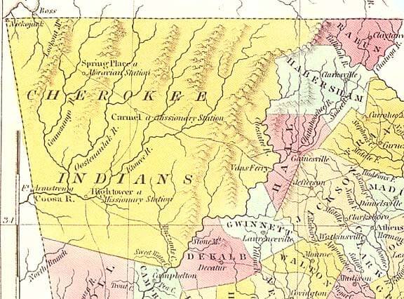
List of the improvements, with the proprietors’ names, on lands ceded by the Cherokees to the United States, by the treaty of the 6th of May, 1828, with the appraised value, &c. annexed.
No. 491 Peter Adams
16 acres land                                          112.00
2 cabins                                                12.00
                                                       124.00
Deduct for fence                                        16.00
                                                      $108.00

No. 492 Robert Livingtom
35 acres land                                          245.00
2 cabins                                                12.00
                                                      $257.00

No. 493 John Adams
6 acres land                                            42.00
Deduct for fence                                         6.00
                                                       $36.00

No. 494 William Egill
5 acres land                                            35.00
1 cabin                                                  6.00
                                                       $41.00

No. 495 Mathew Adams
15 acres land                                          105.00
30 peach trees                                          30.00
2 cabins                                                12.00
                                                      $147.00

No. 496 Baker Tyler
8 acres land                                            56.00
1 cabin                                                  6.00
                                                        62.00
Deduct for fence                                         8.00
                                                       $54.00

No. 497 Charles Kelly
40 acres land                                          280.00
2 cabins                                                12.00
                                                      $292.00

No. 498 Dick Choctaw, on Frog Bayou
3 acres land                                           $24.00

No. 499 The Hips
4 acres land                                            24.00
10 small peach trees                                     5.62 ½
1 set house logs, 16 feet long                           5.00
                                                       $34.62 ½

No. 500 Charles Rogers
2,400 rails                                             12.00
300 clapboards                                           1.50
                                                       $13.50

No. 501 The Girt
2 cabins (indifferent) rails 800                       $15.00


Hello, I’m wondering if you’re able to determine where each of these improvements is geographically? I.E. can they be attributed to a specific plot of land?
Not that I’m aware of Lela.